The Land of Salmon and Sake: How Sakata (Sake Rice Field) got its name
Feat. Sakata Rice Crackers!
Kia ora Koutou, Tim Bunting, Kiwi Yamabushi here on the Japan you never knew you wanted to know.

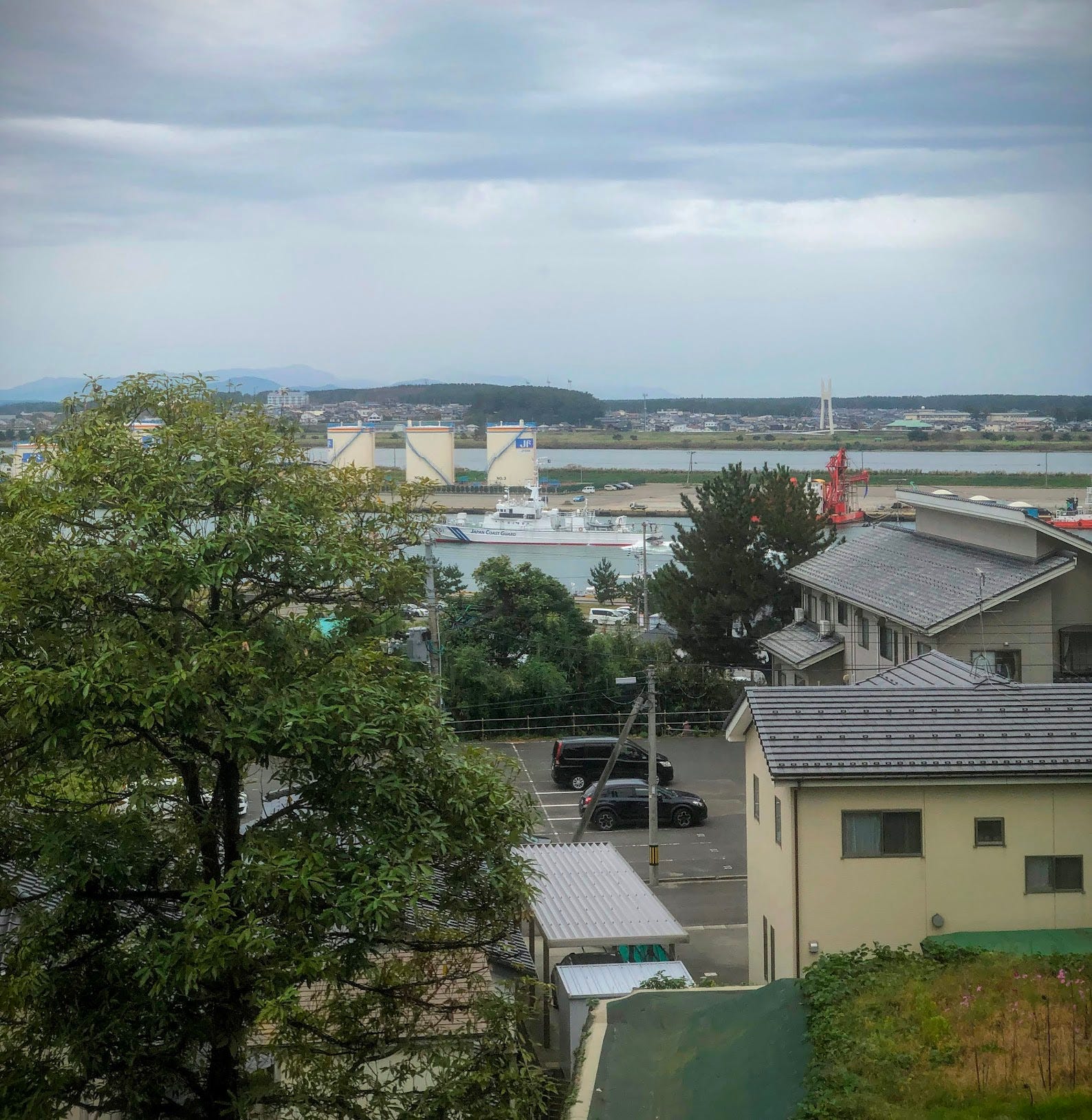
Here I am, sitting on the second floor of a cafe staring out over Sakata harbour.
And I know what you’re thinking.
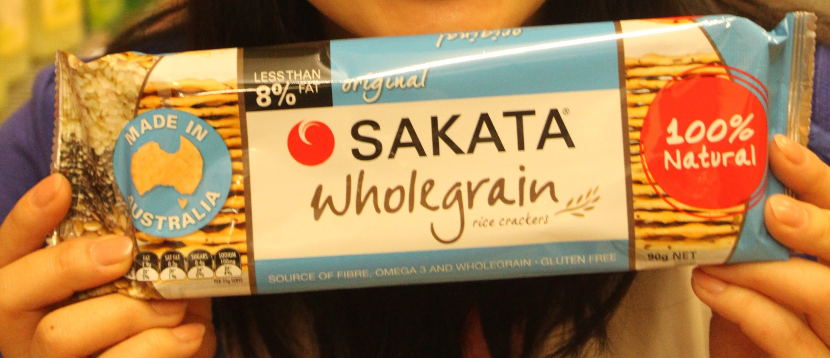
Sakata? Aren’t they that famous brand of rice crackers?
Yes, they are!
Well, for some.
When I was a little kid, we used to have Sakata rice crackers. Not only were they (at least perceived as) healthier, they had a proper ear worm of a theme tune to boot:
Sa…ka…ta…
But when I was working at a supermarket during my university days, someone decided to change their name to this abomination:
Peckish.
Like, what the hell? Sakata is by far the better choice!
Dark days indeed.
At least some countries (well, just Australia, I think) saw the light and kept the Sakata part.
So they should have!

If only the people at Peckish knew the history of the Sakata name, they wouldn’t be so dismissive!
Sakata is currently written 酒田, ‘sake rice field’, the only city in Japan with sake (yes, Japanese rice wine) in its name. In those days, however, Sakata’s name was written 狭潟, ‘narrow lagoon’, or 砂潟, ’sandy lagoon’, similar to the ‘new lagoon’, 新潟, Niigata, to the south.
Apparently Sakata also could have been Saketō, an Ainu name meaning ‘salmon ocean’ after where the salmon gather in the ocean. (Or try Kaisen Ichiba where the salmon gather in my stomach!)
Either way, how did Sakata come to be known as sandy lagoon? And how did it come to get sake in its name?
Let’s find out.
Sakata has existed in some form or another for at least 1200 years. We know this because out in the middle of the rice fields near Yawata lie Kinowanosaku, a late Nara-period (710-794) castle. Kinowanosaku was built as part of the Yamato court’s efforts to claim the land from Emishi tribes way back when Japan wasn’t the least part unified.
This means that at one point in time, Sakata was the border of Japan. There is (apparently) a historical path from Kinowanosaku via Yozo Toge all the way to Tagajo City in Miyagi Prefecture on the other side of Honshu. One day, I intend to walk this path and share the experience with you.
For now though

Modern Sakata started out on the other side of the Mogami River in an area formerly known as Sodenoura. It’s said that in 1521, the ‘Sakata 36’, 36 families of the Oshu Fujiwara family, the Northern Fujiwara, moved to Sodenoura and reclaimed the sandy land there, sandy lagoon. Sodenoura prospered, and in the Middle Ages was an important layover for trade.
Somewhere around this point, the sandy lagoon became a bit too sandy for some. It seems that establishing a city on the sandy banks of a river prone to flooding wasn’t such a bright idea after all.
Evidence of this time can be seen from the sky, of all places. However, it’s a bit too wet for me to get my drone out right now, so Google Maps is going to have to suffice.

The Akagawa River used to meet the Mogami before flowing out into the ocean. Water from two rivers risked flooding Sodenoura, and something had to be done. So, they shifted the flow of the Akagawa River forcing it to go straight out into the Sea of Japan. It may not be that obvious, but the river is making a beeline to the ocean there in Hamanaka.
However, it seems even moving rivers wasn’t enough.
The floods still came!
And what do you do when your whole city is prone to flooding?
Move it!
And that’s exactly what they did.
Over the course of about 100 years, the entire centre of Sakata moved to the other side of the Mogami River, its current location. At that time, the steep hills on this side of the river also meant a name change was in order.
Instead of sandy lagoon, Sakata became 坂田, ‘hilly rice field’.
The Sakata 36 Return
Then in 1672, a very wise fellow by the name of Kawamura Zuiken established the Western Sea Route, a trade route that went around the western coast of Honshu on the Sea of Japan all the way to Osaka and Edo, modern day Tokyo. This Western Sea Route was run by a group called the ‘Group of 36’, after the original 36 families to move to Sandy Lagoon.
However, when Kawamura set up the route, he may have gotten a bit drunk on power. That or the copious amounts of fine sake produced in the region. For whatever reason, Kawamura specifically used the characters for ‘sake rice field’ when labelling Sakata’s port. The name had changed sometime before that.
Now, I have no evidence to prove this, but it’s possible Sakata flourished entirely due to this name change. That, or the high-quality rice or safflower worth more than gold that led to Japan’s Rothschilds becoming the richest family in the country.
Who am I to say!
Either way, Sakata’s name changes reflect the place’s history, and give us a hint as to what the place was like over the centuries.
Plus, it also led to my favourite rice crackers, and a cracking (sorry) theme song too!
Sing it with me…
Sa…ka…ta…
Daily Yamabushi for This Week

Daily Yamabushi posts for the week of November 4 to November 10, 2023.
Read Daily Yamabushi for free at timbunting.com/blog or Medium.com.
This week, the most popular post, although short, was The Real Goal. It was surely a timely reminder for me, and I hope it will be for you too.
Other posts from this week:
I’m readjusting, which is why there are only 6 this week. I try to keep the posts Friday to Thursday, but I seem to have mucked up along the way, (Friday’s post is here though!).
Mountains of Wisdom: Tell Your Friends!
Thanks for your support, and thanks to the support of paid subscribers who make this possible. If you have the means, consider becoming a paid member to receive member-only posts and special insights into the world of the yamabushi.
And, as always, get more content on the Japan you never knew you wanted to know on my blog, YouTube, Instagram, Facebook, Twitter, LinkedIn, Threads, or Medium.com.
Ka kite ano.
Tim.